We often see smart investors get stuck when a prime property sits right in the middle of Zone AE. The confusion usually comes down to decoding an elevation certificate or understanding the true lomr-f letter meaning. These files do not predict the next storm, but they absolutely reveal how a developer planned for one.
Our professional service team uses these exact documents to build out our flood zone list, which currently tracks three new builds in Zone AE as of October 25, 2026.
Here is a straightforward look at what these forms actually mean for your next property decision. Reviewing these details early can save you thousands of dollars down the road.

What is a LOMR-F?
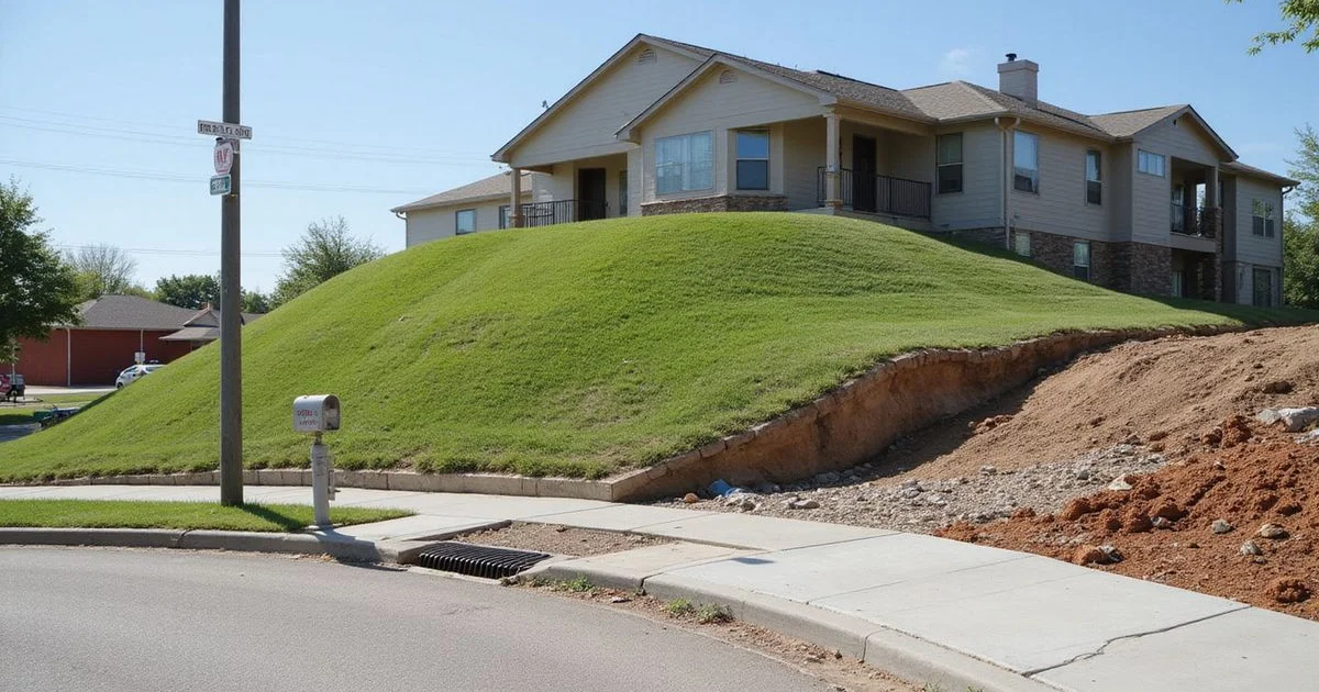
We always start by checking if a property has a letter of map revision fill approval, which is an official FEMA document removing a raised structure from a high-risk floodplain. Developers often elevate a building site with compacted dirt so the new foundation sits safely above the base flood elevation. After finishing the dirt work, they submit an MT-1 form through the Online LOMC portal to revise the map for that specific parcel.
Our records show that FEMA currently averages a 60-day processing window to approve these applications in 2026. If the agency approves the request, the core lomr-f letter meaning becomes clear, as it officially removes that specific structure from the mapped 1% annual-chance floodplain. The surrounding land may still show as Zone AE on the public map.
We tell every client that while this letter removes the federal insurance mandate, it does not eliminate the physical risk of rising water. About 25 to 30 percent of flood insurance claims come from properties outside designated high-risk zones. This statistic proves why dropping coverage is rarely a smart business decision.
What is an elevation certificate?
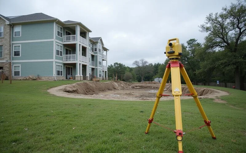
Our next step involves reviewing the elevation certificate apartment managers keep on file, which is a standardized form completed by a licensed surveyor or engineer. It records the building’s key heights, like the lowest floor, and compares them with the base flood elevation (BFE) for that exact spot. The current FEMA Form FF-206-FY-22-152 is valid through June 30, 2026.
We closely examine the main line comparing the lowest floor elevation against the BFE. A building whose lowest floor sits above the BFE was designed with that safety margin in mind. Hiring a professional to complete this measurement typically costs between $400 and $900 in the US this year.
Our clients often use a favorable certificate to negotiate lower premiums with private flood insurance carriers, even though FEMA’s Risk Rating 2.0 no longer strictly requires the form.
These are documents, not guarantees
A LOMR-F or an elevation certificate tells you how a building relates to the mapped floodplain. It does not cover street flooding, drainage issues, or every single storm. We share the documents and the verifiable facts, without issuing final verdicts on a property’s safety.
Where do the three Zone AE buildings stand?
Three specific properties currently sit on the watch list for new documentation. None of these three developments is located inside the City of Houston limits.
Our tracking board updates their status cards the moment new surveyor documents arrive. Because they sit outside city limits, Houston’s strict Chapter 19 floodplain rules do not apply to them. That specific 2018 ordinance requires new building slabs in the city to sit two feet above the 500-year flood elevation.
We monitor these county properties using different compliance standards. The table below outlines the current status of each location. This data gives you a clear snapshot of their progress.
| Building | Zone (Oct 25, 2026) | Document status |
|---|---|---|
| Asher Towne Lake | Zone AE | LOMR-F letters pending |
| Sycamore Heights | Zone AE | LOMR-F letters pending |
| The Cove at GYB | Zone AE | 11-foot BFE; elevation certificate requested |
How do we request these documents?
Our standard process involves asking the community management in writing for specific flood records on every Zone AE or shaded X building on your shortlist. This ensures you have all the facts before signing a lease or purchase agreement. The requested packet includes four main items.
- Any LOMR-F or other map letter, approved or pending
- The elevation certificate, if they will share it
- The §92.0135 flood notice and the five-year flooding answer
- What the emergency generator covers during a power outage
We share what the developers send over and carefully note what they refuse to provide. A missing file often serves as a red flag for potential buyers. Reading through the background on these hazard areas can be helpful, so please check the guide on FEMA flood zones to understand X, shaded X, and AE designations.
Our team relies on this exact checklist to keep property evaluations objective.
How to read the key lines on an elevation certificate
Elevation certificates contain highly technical data, but a few specific lines matter most for a property decision. The most critical comparison is the lowest floor against the BFE.
We always check Section C of the form, as this area requires a surveyor’s official seal and cannot be completed by the owner. A lowest living floor built above the BFE was designed with a clear safety margin. A garage or parking level may sit lower than the living floors, so ask how the property manager treats the parking area.
Our table breaks down the essential items you need to locate on the document.
| Item | What it means |
|---|---|
| Flood zone and BFE | The zone at the site and the base flood elevation, in feet |
| Top of bottom floor | The height of the lowest finished floor |
| Lowest adjacent grade | The ground level right next to the building |
| Building diagram number | The type of foundation, like slab or elevated |
A diagram number of 1A indicates a standard slab-on-grade foundation. This foundation type is extremely common and generally requires the fewest measurement points.
We recommend focusing heavily on the lowest adjacent grade, as this shows the ground level immediately touching the foundation.
What “pending” means
A pending LOMR-F status means the developer has applied, or is preparing to apply, and FEMA has not issued a final decision yet. Until the agency officially approves the MT-1 application, the current map still shows the original hazard zone.
Our database keeps the property card on the original zone and clearly notes the pending letter. The wait time can delay closing schedules for commercial buyers relying on the map change for loan approval. Local floodplain administrators must review the application before it even goes to the federal level.
We advise clients to secure temporary flood insurance quotes while waiting for the final paperwork to clear.
Could the map change anyway?
It absolutely could change. Harris County’s MAAPnext project has draft maps that will likely redraw several local zones.
Our research shows these draft maps were released in February 2026, but final adoption is not expected until 2028. A LOMR-F applies only to the current effective map. When the new models take effect, properties might experience several changes.
- Shifting from Zone X into a higher risk category based on Atlas 14 rainfall data.
- Facing new federal flood insurance mandates from lenders.
- Encountering stricter local elevation rules for future expansions.
We maintain a comprehensive guide on MAAPnext draft maps that covers what these drafts mean for a building’s future status. Send the specific buildings you are considering to our office. The team will pull the FEMA record and share the findings with you the same day.
Our goal is to help you grasp the complete lomr-f letter meaning and make a confident choice before you sign a contract.